June 29, 2023
Types of Radar Observations for Precipitation and Wind InformationRadar technology plays a crucial role in aviation, providing vital information about precipitation and wind that helps ensure the safety and efficiency of flights. There are four primary types of radars used in aviation for this purpose:
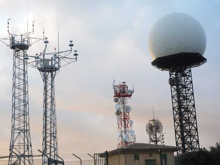
Commonly known as Doppler radar, the WSR-88D NEXRAD radar provides comprehensive observations that inform surrounding communities about impending weather. It operates in two modes: clear air and precipitation.
The radar is in its most sensitive operational mode in clear air mode, with a slow antenna rotation allowing for extended atmospheric sampling. Images are updated approximately every 10 minutes in this mode.
In precipitation mode, the radar operates with a faster antenna rotation due to stronger return signals from precipitation targets. This allows images to update faster, approximately every 4 to 6 minutes. The intensity values in both modes are measured in dBZ (decibels of Z) and are depicted in color on the radar image.
Installed at some major airports, the TDWR aids in providing severe weather alerts and warnings to Air Traffic Control (ATC). This terminal radar ensures pilots are aware of wind shear, gust fronts, and heavy precipitation, which are all dangerous to arriving and departing aircraft.
Primarily used to detect aircraft, this radar also detects the location and intensity of precipitation. This information is used to route aircraft traffic around severe weather in an airport environment.
Airborne radar is equipment carried by aircraft to locate weather disturbances. These radars generally operate in the C or X bands (around 6 GHz or around 10 GHz, respectively), allowing both penetration of heavy precipitation, required for determining the extent of thunderstorms, and sufficient reflection from less intense precipitation.
In addition to these radar systems, satellite technology advancements have allowed commercial use to include weather uplinks. Through the use of satellite subscription services, individuals can now receive near real-time weather information for the North American continent.
Radar observations are a critical component of aviation weather services. They provide valuable information about precipitation and wind, enabling informed decision-making regarding flight safety. By combining different radar systems, aviation professionals can comprehensively understand the weather conditions they may encounter during flight.
Affiliate Partner Program | Jobs at Spartan | Terms of Use | Privacy Policy | Opt-out Policy | Privacy Notice - California Residents| Notice of Non-Discrimination | Website Accessibility Help | Transparency in Coverage Act| Cookie Settings | AI Reference Page | LLM Info (TXT)
© 2026 SPARTAN COLLEGE OF AERONAUTICS AND TECHNOLOGY. ALL RIGHTS RESERVED.